Day 1 We're Off! Home
Introduction / Background
Calendar of Dates
Map of Complete Route
Terminology
Related Links

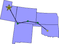
Route from Utah to Oklahoma
Date:      Friday, July 18, 1997
States:    UT, NM, CO, KS, OK
Weather:   CAVU
Altitude:  12,500 ft MSL
Dep Time:  7:29am MDT (1329 UTC)
Arr Time:  3:55pm CDT (2055 UTC)
Airtime:   6 hr 23 min
Distance:  803 nm
Avg Speed: 128 kts
Fuel Burn: 79 gal

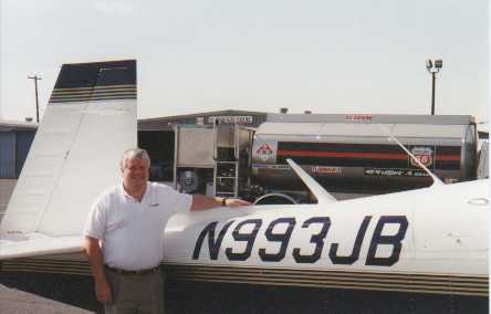
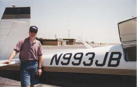
    At last we left Provo this morning flying direct to Farmington, New Mexico (FMN). And though it isn't really all that far, instead of following the usual zigzag of airways, we just dialed Farmington in as our destination on the LORAN receiver and away we went. Our track took us over some high country west of Price, Utah and then out over the Canyonlands area. We flew directly over the confluence of the Green and Colorado Rivers and what a tremendous sight. Then over Monticello, Utah and on into Farmington. The good folks at Four Corners Aviation at Farmington were very professional and cleaned the windscreen! Very nice. We took a couple of pictures and mailed our first envelope back home. We took just a 15 minute break and launched again.

Farmington, NM


    Heading for Trinidad/Stokes, Colorado (TAD) we traveled over Alamosa and a little north of a direct route to cut through a pass in the front range there. Trinidad was a rather small airport that at one time had a lunch counter and a Flight Service Station in the little terminal, but no longer. The folks there were nice enough, giving us a free candy bar with our fuel. Another envelope sent via the airport manager walking it to the box on the highway! We forgot a photo.


    Then on to what was to be Elkhart, Kansas, but when we arrived we found a brand new runway painted but X'd out and so was closed. We continued east trying to raise someone on the ground at Hugoton, Kansas with the radio, but with no answer to our calls, we went on to Liberal, Kansas (LBL) which at one time had been a WWII training facility. The folks there were very nice and promised to mail another envelope. By this time, we were well into the afternoon and the wind was up, gusting to 20 knots, but we were still excited about our adventure and decided to mosey on to Chickasha, Oklahoma (CHK).

Liberal, KS


    Chickasha, which is pronounced ‘Chick-uh-shay' – not ‘Chick-uh-shaw' like we first thought. (we were corrected, thanks to Oklahoma City Approach) – is a small town of about 21 thousand people south of Oklahoma City. We landed, got fuel, and hangered for the night by the nice folks at Chickasha Aviation. We called for a taxi into town for a motel. Not fancy but has a bed and air conditioning. Temps have been around 90-92 degrees everywhere we've landed since Farmington, so we flew high (9.5K to 12.5K) to beat the heat.


Return to top of pageNext - Day 2
Copyright © 1998 by Jared Blaser. All rights reserved.