


 |
Day 13 | I didn't know that Angola was in the US, did you? |
      |
|
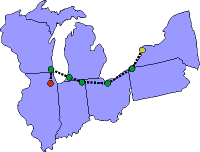
Date: Wednesday, July 30, 1997 States: NY, PA, OH, IN, MI, WI, IL Weather: CAVU Altitude: 6,500 ft MSL Dep Time: 9:22am EDT (1322 UTC) Arr Time: 2:08pm CDT (1908 UTC) Airtime: 3 hr 48 min Distance: 498 nm Avg Speed: 131 kts Fuel Burn: 48 gal |
|
Well, we covered a lot of ground today. We left Niagara (IAG) after a taxi ride to the airport. We turned a little south toward Buffalo to stay closer to the shore line as we flew to Erie, Pennsylvania (ERI). We had a nice approach into Erie with beautiful clear skies and we took a number of pictures as we flew along later in the day. |
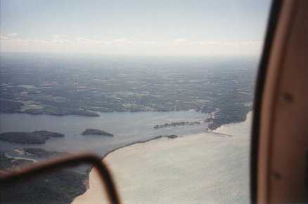 Lake Ontario
|
|
|
ATC, as usual, was good today and we were given handoffs to each approach as we came through. The approach controller at Toledo, Ohio (TOL) 'lost' us for a few minutes when they were not reading our transponder squawk but everyone else picked us up just fine. We landed in Toledo and fueled up. |
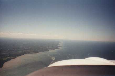 Lake Ontario, near Cleveland
|
|
|
At Angola, Indiana (ANQ), we didn't even shut down. The guy that ran this small airport was all set up with a handheld and called us up as we announced ourselves on unicom and asked about what we needed. A real gadget junky, gotta do it officially, kind of guy. Bill hopped out and gave the man a $5 bill and asked him to put a business card in the envelope and mail it. Then we blasted off again. Our flight to Benton Harbor, Michigan (BEH) was fast, and we landed at the airport which is very close to the shore of Lake Michigan. There were a couple of guys in the pattern doing landings and it seemed a big airport for just a unicom. As we landed we could see that Benton Harbor used to have a tower, but now just doesn't have the traffic. Though we did see a NorthWest commuter plane at the little terminal load up and blast off, no bigger jets come here anymore. The FBO was nice, clean, and was attached to the main terminal which was convenient. We took fuel and aimed for the water. |
||
|
The flight over that big, 60-mile stretch of water at first was a little scary, but as we leveled out and settled into the cruise mode, our situation became more comfortable. In only 20 minutes we had crossed the lake and were descending to Kenosha. We stayed high too long and had to bring out the gear and flaps to come down quickly. But we made it in just fine and got our fuel. Bill had called his contact in Chicago and found that he was working in Naperville that day so, rather than going to Meigs Field, then to Clow (1C5), we went direct to Clow. There we would separate and then on Friday morning Jared would solo to Meigs and pick up Bill there. |
 Lake Michigan, with Chicago way in the distance
|
|
|
So we flew around the major airports at Chicago and into Clow. What a fun little operation! The strip is pretty old, bumpy and has weeds growing in the cracks, but it worked just fine. |
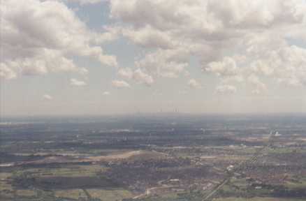 Chicago Suburbs
|
   |
||
| Copyright © 1998 by Jared Blaser. All rights reserved. |