

 |
Day 21 | Round Robin Two... and home at last! |
      |

|
Date: Thursday, August 7, 1997 States: (UT), CA, AZ, NV, UT Weather: CAVU Altitude: 10,500 ft MSL Dep Time: 7:37am MDT (1337 UTC) Arr Time: 2:02pm MDT (2002 UTC) Airtime: 5 hr 35 min Distance: 736 nm Avg Speed: 132 kts Fuel Burn: 70 gal |
|
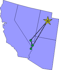
Bill made our takeoff and we followed the VORs south via DTA, MLF, MMM, then to Needles (EED). We flew at 10,500 feet and had a nice, cool, and smooth flight. When we got to Needles we were still a little high and fast, so we did a big 360 out from the airport a ways and then came in on runway 11. Bill's landing here was a 2.99-point pronger and we giggled a little. We parked near the pump and got the envelope out. The guy that fueled us also flew a Mooney, an older C model, and he told us how he's slowly putting the mods on it and making it faster. It's a nice comradery that Mooney pilots have one with another. |
||
|
|
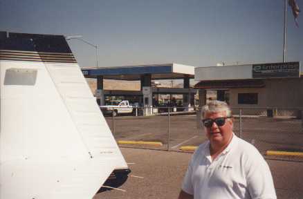
 Laughlin, NV / Bullhead, AZ
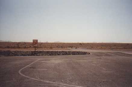
 Bullhead, AZ taxiway to runway on hill
|
|
|
Bill got us off the ground and tower cleared us for a southward downwind departure, even though we wanted north to Provo! Anyway, we contacted Las Vegas departure and they cleared us to 4000 feet on a heading of 070. Unbelievably, this took us right to some jagged peaks, and we had to dodge them a little. Of course, we were always safe and well clear, but the controller needs to go fly that particular route sometime and see for himself what he points people at! Our route back home was just the reverse of coming down: MMM, MLF, DTA, then Provo. We had occasional bumps but mostly smooth air, and at 9,500 feet we were cool enough. Bill tuned the ADF to local AM stations as we flew home. We listened to Rush Limbaugh for a while, then we tuned in KDYL and listened to the old classics from the 50's and 60's. It was fun. On into Provo using runway 13. |
   |
||
| Copyright © 1998 by Jared Blaser. All rights reserved. |